🚁Skyrocket Your Drone Mapping Skill to Next Level🚀
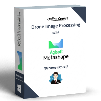
Drone Image Processing with Agisoft Metashape
Discover the power of drone photogrammetry with our comprehensive online course to enhance your drone image processing skill

3+ Hours of videos
10+ Sample Dataset

24/7 Community Support

2 Live Project Support
LIFE TIME ACCESS WITH FREE UPDATE

Watch Course Preview

Leo Stalin MSc (Geo-Informatics)
(Geospatial Engineer l Drone Pilot l Metashape Instructor at Udemy l Pix4D & Bentley Certified Professional l Blogger l Research Journal Writer | Member ISPRS, ASPRS, ISG, ISRS)
(View Full Profile: Click Here)
Connect Me
👨🏫About Instructor
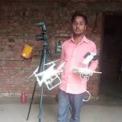
Leo Stalin is a Highly Experienced Geo-Spatial Engineer and Drone Pilot with 10+ years of expertise in the Geospatial Industry. He has successfully managed GIS, Photogrammetry, and UAV projects across diverse industries including Mining, Inspection, Oil & Gas, Agriculture, Disaster Management, Renewable Energy, Utility, and Construction Management. He has a strong background skills in UAV Aerial Image Acquisition and Processing various sensors data such as RGB, Thermal, LiDAR, and Multispectral. Notably, he has processed 1,50,000 images as a single project, demonstrating his capability to handle large-scale operations using High Performance Computing.
As an Instructor at Udemy, Leo teaches the course titled "Drone Photogrammetric Image Processing Beginner to Expert," earning a notable rating of 4.3/5 and trained around 700 students from 70 Plus Countries. In addition, he is a certified Professional in Pix4D Mapper and Bentley Context Capture for Reality Modelling, a HPC Architect for Drone Image Processing, and a member of prestigious organizations such as ASPRS, ISPRS, ISG, and ISRS. As Researcher he published more than 10 research paper in peer reviewed research journals internationally.
Leo has worked with prominent organizations such as ZainTech (Dubai, Kuwait), MIT - Anna University, Chennai, GeoAdithya Technologies, Lotus Geosolution, and Empower Consultancy, holding positions such as Manager, Senior Drone Pilot, Team Leader, Technical Manager, and Senior Orthophoto Executive, showcasing his growth and leadership in the field. Leo's educational background includes an M.Sc. in Geo-Informatics, with First Rank and he has received "University Golder Medal" for the same.
📚Course Curriculum - Download
📁3 Module 📹40+ Videos
⏰3h 16m Total Length
Module 1
Basics of Drone Photogrammetry
📸1.What is Photogrammetry?
01:36
🌐2. What is GSD or Spatial Resolution?
01:38
🚁3. How to Select Drones and Sensor for Mapping Application?
03:34
🗺️4. What is AOI and GCP?
02:03
📋5. Check List for Drone Image Processing...!!!
01:27
Downloadable Check list PDF file
Module 2
Drone Image Pre-Processing
🌐6. How to Geotag Drone Images using ExifTool?
05:55
Sample Drone Image Dataset + ExifTool + Script file
02:25
🌐8. How to Geotag the Single Image using Online Tools?
03:03
Windows Link + Sample Image for Geotag
📍9. How to Extract Image Coordinates using ExifTool Script?
02:23
Sample Geotagged Images Dataset + ExifTool + Script file
01:52
Sample Geotagged Images Dataset
01:43
Sample Geotagged Images Dataset + Windows App Setup File
🔴12. How to Create Point Shape File from Coordinate Text File using QGIS?
03:44
🗺️13. How to Automatically Create KML file from Geotagged Images?
01:13
Sample Geotagged Images Dataset + Windows App Setup File
🚫14. How to Remove Geotag Information from Images using ExifTool?
02:41
Sample Geotagged Images Dataset + Exiftool + Script File
02:00
Sample Geotagged Images Dataset
🚫16. How to Remove Geotag Information from Images using Windows App?
01:52
Sample Geotagged Images Dataset + Windows App Setup File
📂17. How to Rename the Drone Images using Windows Command Prompt?
04:10
Sample Image Dataset + Windows Rename Script File
📂18. How to Automatically Rename the Drone Images using Windows App?
01:24
Sample Image Dataset + Windows Setup File
🎨19. How to do Batch Color Correction Using Photoscapex?
01:24
Sample Image Dataset + Windows Setup File
💻20. Minimum Hardware Requirement for Installing Agisoft Metashape?
00:46
Hardware Specification Link
🔧21. How to Install Agisoft Metashape on Windows?
02:02
Windows Setup File Download Link
⚙️22. What are the Agisoft Metashape Immediate Settings?
01:19
Module 3
Drone Image Post Processing
🚁23. How to do UAV/Drone Nadir Aerial Image Processing with GCP for GIS Data Generation?
28:27
Sample Drone Image Dataset + GCP File + QGIS Setup Link
🔄24. How to do Batch Processing to Automate the Data Generation?
05:48
Downloadable Batch Processing Script File
🗺️25. How to Classify the 3D Point Cloud to Generate DTM, Contour and Conventional Orthomosaic?
06:49
Sample Drone Image Dataset + GCP File
✏️26. How to Edit DEM File?
03:07
Sample Drone Image Dataset + GCP File
🎨27. How to Export Seamline, Orthos and do Color Correction in Orthomosaic?
06:36
Sample Drone Image Dataset + GCP File
🔗28. How to Align and Merge Junks?
09:03
🎥29. How to Create Flythrough Video for 3D Model?
03:04
Sample Drone Image Dataset + Flythrough Files
📏30. How to Perform Volume Calculation and Measurement?
12:20
Sample Drone Image Dataset + GCP File + Sample Volume Calculation Report
📤31. How to preprocess the PPK Images?
04:12
PPK Image Dataset + Base/Rover Log Files + PPK Software
🛰️32. How to Process RTK and PPK Images?
05:42
📸33. How to Create Photogrammetry Stereo File for AT Result?
03:54
Sample Drone Image Dataset + GCP File
🔄34. How to Create Spherical Panorama?
04:29
🛰️35. How to Process Stereo Satellite Image?
07:23
Sample Stereo Satellite Image with GCP File
🌐36. How to Processing Drone Images using Network Processing Mode?
13:52
Sample Drone Image Dataset + Network Batch Script File
☁️37. How to Processing Drone Images in Cloud Processing?
04:55
Sample Drone Image + Batch Processing Script
🌡️38. How to Process Thermal Images?
08:18
Sample Thermal Image Dataset + Temperature Conversion Formulas
🌈39. How to Process Multispectral Images?
12:52
Sample Multispectral Image Dataset + Indices Formulas
📏40. How to Perform Accuracy Assessment for GIS Data Product?
03:55
NSSDA, ASPRS Guideline PDF + Accuracy Assessment Table
Instructed by Leo Stalin
Lifetime Access of the Course
Learn Anytime, Anywhere
Sample Dataset for Own Practice
Android and IOS App
Live Project Support
24/7 Instant Email Support
⏳Hurry Up! Reserve Your Seat Now🪑
Download Course Details in PDF for Free
Here’s Some of Our Student's feedback...
Well explained about the concept and the tools in agisoft metashape.
Raj Kumar
Drone Pilot
Happy to learn about new advanced features of the software.

Yrving Rommel
GIS student
Really helpful. Instructor has good knowledge in Agisoft Metashape.

Waqas Ahmad
GIS Consultant
The course have a very helpful information.

Nidia v Martinez
GIS Consultant
Presenter is very clear and concise about each topic.

Austin Odo
GIS sPecialist
very thorough discussion of drone image processing.

Larry Whitson
Suveyor
🚁Drone Image Processing with Agisoft Metashape📸
3hrs of Video
40 Lessons
🚁Why are you waiting? Enroll now and elevate your skills in drone image processing to new height🚀
Frequently Asked Questions
Who is this course for?
This course is for Drone Pilots, Surveyors and Geospatial Professionals who want to learn the Drone Image Processing with practical example.
Is there any specific skill is required to take this course?
No, But if you have basic knowledge in Drones, GIS, Remote Sensing and Survey concepts that will be advantage for you.
Is there any specialized hardware is required to take this course?
Yes, You need PC or Laptop with minimum 1 GB graphics card is required.
Do I need any software license is required to take this course?
No, You can download the trail software online and the software download and installation guide will be provided as video.
Do I need drone pilot license is required to take this course?
No, Drone Pilot License is not required to take this course.
Do I need drone for data acquisition for this course?
No, It is not required, all the drone sample images are attached with each video for your own practice.
Do I provide any specialized support after enrollment?
Yes, online chat, message, email and community support available by 24*7.
Do I provide any specialized support after training?
Yes, we will provide 2 live project support after the completion of the course.
Is there any certificate provided after the successful completion of course?
Yes, we will provide course completion certificate upon the successful completion of course.
🚀Drone Image Processing with Agisoft Metashape🚁
(Use Coupon: CA224 to Get Upto 75% Off)
🌟🎉🚨 (Offer Valid for First 20 Enrollment) 🚨🎉🌟
Copyright © 2023 Drone Image Processing Hub. All Rights Reserved.